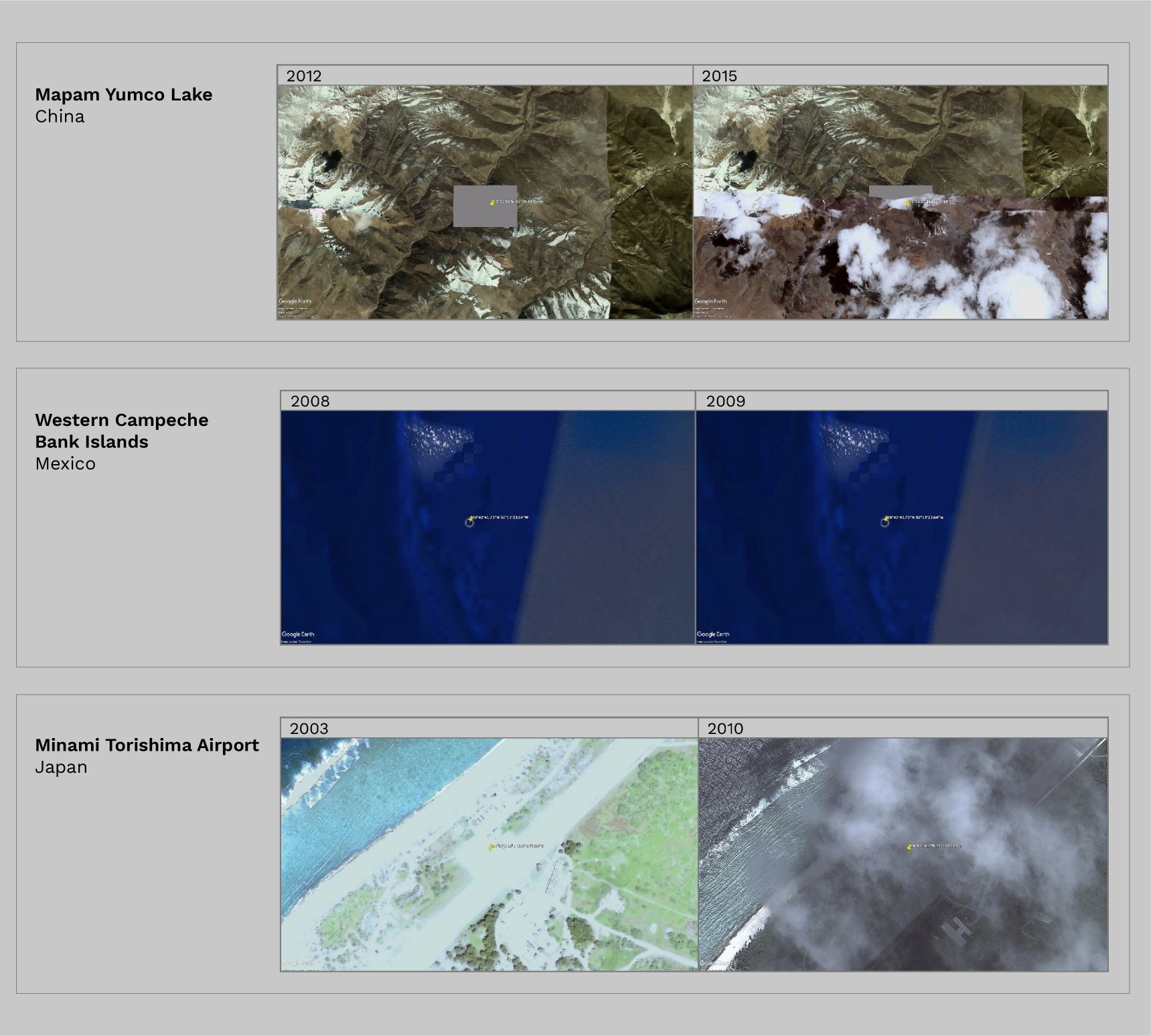
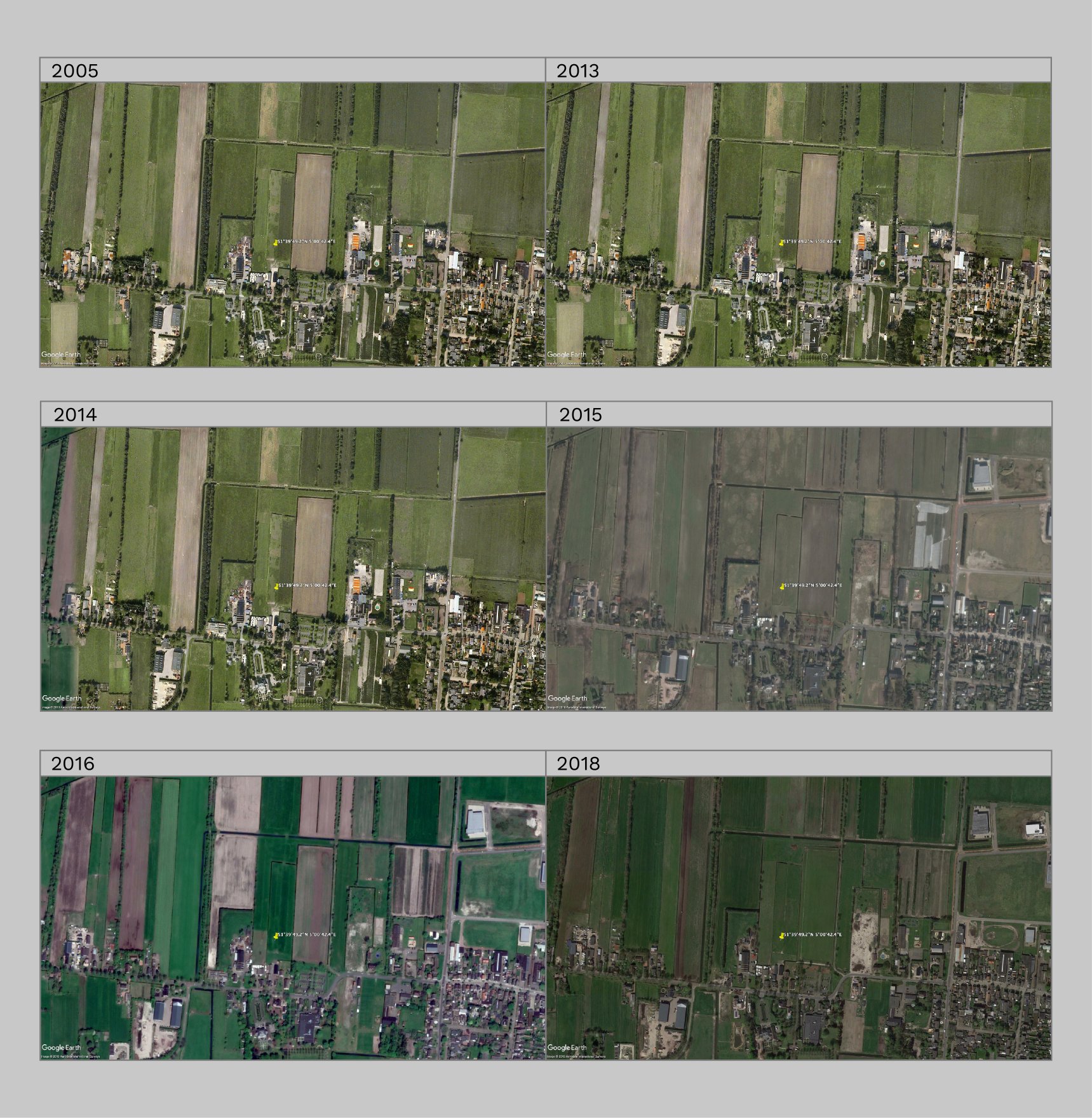
While available satellite images allow exploring all the places on Earth, they also show which of them have been censored. Google Earth Pro, unlike Google Maps, enables users to see places timelines, and how censorship is applied, despite there are no images of each year. The analysis wants to give back a historical view of how this phenomenon and its visual languages have changed over time.
Main Findings
Many places alternate censored photos with uncensored photos over the years, sometimes even in the same year. Moreover, in almost half of the places, the type of censorship changed through time.

The techniques of censorship vary based on the type of cluster: the most used techniques are pixels and low-resolution images for military areas, blurring and covering areas for facilities, covering for natural areas and islands.
The covering technique is the most used method of censorship. The places can be covered by regular or irregular geometric forms, by repeating the same satellite photo from the past over the years, or by using colour modification.

On Google Earth Pro, respectively, Area 51 (US), Camp Shorabak (AF), Tel-Aviv (IL), Moronvilliers (FR), a house in the Netherlands, Western Campeche Bank Islands (MX), Faroe Islands (DK), Janette and Severnaya Zemlya Islands (RU), and Atoll Moruroa (PF) are always censored over time, except some years that don’t show the images.

Respectively, Camp Buckner and Tonopah Test range (US), Ingolstadt Airbase (DE), Israel, North Korea, Rosas (ES), Syracuse Hancock Airport (US), an unknown place near Kos (GR), Alexey Miller’s house (RU), Baker Lake (CA) and Antarctica appear as censored places in the research on Google Search, but they have never been censored on Google Earth Pro.

A private house in the Netherlands is always covered by a field in all the satellite photos available on Google Earth Pro.

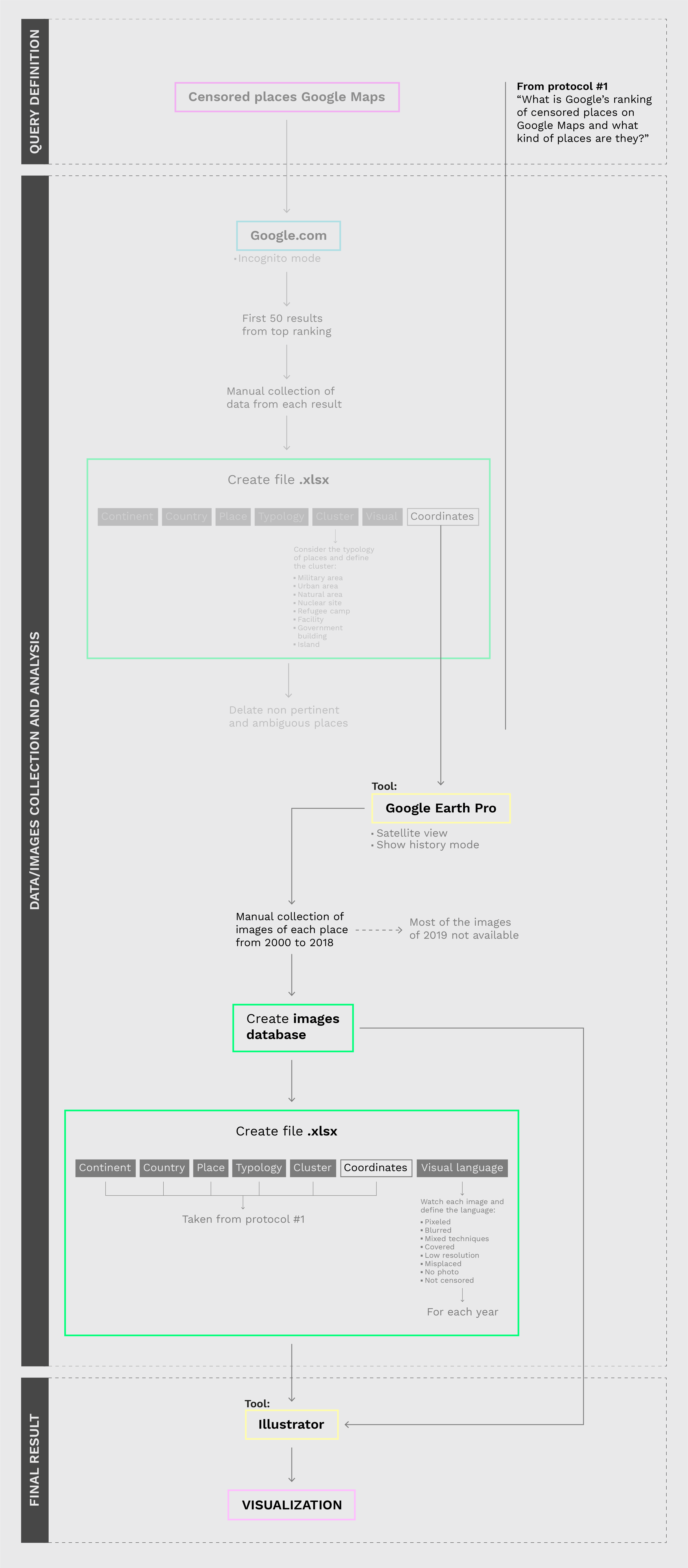
Protocol
